I drew a map to direct people in our Wellington sketching group to a future sketching meetup in Paraparaumu. I definitely need to get a scanner (or access to one)! Maps are always lots of fun to draw.
Showing posts with label Hand-drawn maps. Show all posts
Thursday, May 30, 2013
Friday, January 4, 2013
Sketchcrawl: Matui Somes Island
On Friday, we visited Matui Somes Island, which is the middle of Wellington Harbour. We caught the ferry across from Days Bay, which is always a great day trip. My super-husband volunteered to look after the kids on the island for a while so I could do some sketching! He's a keeper, that one.
View from the island looking towards Eastbourne
The island was named Matui by the Polynesian explorer Kupe, after one of his daughters. The europeans named it Somes Island, and nowadays the island is called by both names.
Sheep on the island
In recent history, the island has been a quarantine station, an internment camp, a military base with gun emplacements and a degaussing station (that is where the WRENS demagnitised the hulls of boats), and most recently, a wildlife sanctuary.
The Matui Somes Island lighthouse. I sketched this from the hill behind it, near the gun emplacements. There is a large seagull population on the island, but they left me alone while I sketched!
The wind really picked up by now, and I realised that the seagulls were soaring in the wind very close to me. So they were almost stationary in the wind, which was a great chance to sketch them. I practised using a medium tipped grey pen again. Although I think a finer tip would have been better.
This is the sheep shed, which is one of the many old buildings on the island. By now it was so windy, I was actually being buffeted by the wind. So I turned my sketchbook upside down, so the wind would not whip the pages - worked a treat. But I think if I had been using a free-flowing ink pen, the wind would have actually blown the ink across the page, it was so strong. Medium tip Staedler grey pen.
We played on the beach on the lee side of the island for while, waiting for the return ferry. We could actually see starfish in the rockpools, and the fastest moving shellfish I have ever watched. It was like watching a slow-motion dodgem cars. My three-year old and I were transfixed for abou 10 minutes just observing them. Then I sketched the wharf above, although the ferry came before I could put the wharf crane in. Still, although it took longer, I prefer this style of sketching with a finer 0.05 black pen, than the bigger medium tip grey pen.
A map of our day.
A gratuious photo of somewhere completely different, a church in Northland, New Zealand.
Wednesday, December 26, 2012
Sketchcrawl around Karori and Makara
We went for a drive to the West Winds Recreation Park, near Makara, north of Wellington. I took my sketchbook with me, on the off chance that I would have time for a few sketches...
It was a bright sunny summer's day, with a beautiful blue sky. We went over the hill into Karori, which has always had its own weather, a bit like Brigadoon. The Karori was covered in a thick fog. ???? We went on anyway.
The park actually has ruins in it of quite a large base, including gun emplacements and an old radio station. It was really strange to think of New Zealand having ruins like this.
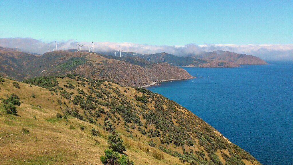
We walked around the massive wind turbines, which was very strange. They are so big that an Airbus A380 plane could sit in this middle of the wind turbine wings, with lots of room to spare. It looked like there was 70 - 80 of them on the hills, all moving except for one, who looked like he was in charge. The day was starting to feel a bit surreal, as if we were in some kind of Dr Who scene. The wind turbines moved in and out of the thick fog.
Then we went down to Makara Cafe and Beach. Here is my 3 year old climbing over an old boat, which is sitting smack bang in the middle of the cafe. Oddly enough, this was not surreal, because this is very common in Wellington cafes.
We drove on back through Karori, which was now bright and sunny. Over the hill, we discovered that the rest of the world was now covered in a pea souper fog. We drove down to Happy Valley to the coast, to Carlucci Land. I had never been here before, and got out of the car, in the fog, to be surrounded by the most fantasical animals and metal sculptures. This guy in this valley has made all these structures and sculptures from scrap metal. Now it was like being in a Salvador Dali painting (in the fog).
Well, we made our way home now, driving along the coast, watching the fog obscure things.
I think that by sketching things, and observing them so closely, it made everything seem quite different. Otherwise, I probably would have just glanced at things and moved on, unaffected. But that made the day really interesting for me.
It was a bright sunny summer's day, with a beautiful blue sky. We went over the hill into Karori, which has always had its own weather, a bit like Brigadoon. The Karori was covered in a thick fog. ???? We went on anyway.
The park actually has ruins in it of quite a large base, including gun emplacements and an old radio station. It was really strange to think of New Zealand having ruins like this.
We walked around the massive wind turbines, which was very strange. They are so big that an Airbus A380 plane could sit in this middle of the wind turbine wings, with lots of room to spare. It looked like there was 70 - 80 of them on the hills, all moving except for one, who looked like he was in charge. The day was starting to feel a bit surreal, as if we were in some kind of Dr Who scene. The wind turbines moved in and out of the thick fog.
Then we went down to Makara Cafe and Beach. Here is my 3 year old climbing over an old boat, which is sitting smack bang in the middle of the cafe. Oddly enough, this was not surreal, because this is very common in Wellington cafes.
Well, we made our way home now, driving along the coast, watching the fog obscure things.
I think that by sketching things, and observing them so closely, it made everything seem quite different. Otherwise, I probably would have just glanced at things and moved on, unaffected. But that made the day really interesting for me.
Gratuitous photo of Dunedin Harbour, South Island, New Zealand
Wednesday, February 1, 2012
Map of paddling the Clutha River

I´ve just read Jill Berry´s amazing book Personal Geographies, and had a go at drawing a map of the first few days of our paddling trip down the Clutha River, from Lake Wanaka to the sea. This drawing is just a bit of a practice go, and before I knew it, my six year old had started colouring it in. But at least he let me choose some of the colours he used.
The book Personal Geographies is probably the only one on the topic of hand-drawn maps that I have found that approaches it from a journalling and crafter´s perspective. Other books like Strange Maps, or You are Here, which had very good reviews, I found very disappointing. They included some interesting material, but very few pictures of anything I thought ¨I´d like to do something like that¨.
Tuesday, January 3, 2012
Subscribe to:
Posts (Atom)